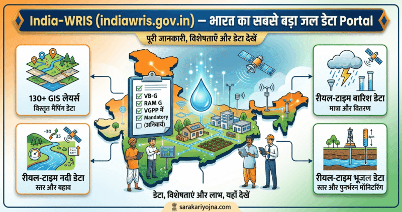
📌 अपडेट (2026): India-WRIS अब 130 GIS layers के साथ — static, dynamic और semi-dynamic water resources data — एक platform पर। National Water Informatics Centre (NWIC) इसे manage करता है — Ministry of Jal Shakti के under। VB-G RAM G के VGPP Framework (June 2026) में IndiaWRIS को mandatory data source बनाया गया — Gram Panchayat level Water Budgeting के लिए।
एक Gram Panchayat को VGPP बनाना है। पूछा — “हमारे ब्लॉक में groundwater कितना है? Over-exploited है या safe?”
पहले — Block office जाओ, CGWB report मांगो, महीनों wait करो।
अब — indiawris.gov.in खोलो। District और Block select करो। Real-time groundwater data, river flow, rainfall — सब 2 मिनट में।
यही है India-WRIS।
संक्षेप में
India-WRIS (India Water Resources Information System) एक web-based portal है — indiawris.gov.in — जो India के water resources data को एक comprehensive, authoritative और consistent national GIS framework में provide करता है। यह CWC (Central Water Commission) और ISRO के MoU (December 3, 2008) से शुरू हुआ। अब इसे NWIC (National Water Informatics Centre) — Ministry of Jal Shakti का subordinate office — manage करता है। यह VGPP Water Budgeting और Yuktdhara Planning Portal दोनों में integrated है।
एक नज़र में
| विवरण | जानकारी |
|---|---|
| Portal | India-WRIS (India Water Resources Information System) |
| URL | indiawris.gov.in |
| Ministry | Ministry of Jal Shakti |
| Managing Agency | NWIC (National Water Informatics Centre) |
| NWIC Notification | 28 March 2018 |
| Origin | CWC + ISRO MoU — 3 December 2008 |
| GIS Layers | 130+ |
| Data Groups | 5 major groups |
| Info Systems | 12 major + 36 sub |
| Attribute Data | 5-100 वर्ष |
| Data Sources | CWC, CGWB, IMD, NRSC, State Govts |
| Key States Data | AP, UP, Gujarat — regular |
| Dashboards | Rainfall, River Level/Discharge, Water Bodies, GW Levels, Reservoir, ET, Soil Moisture |
| Access | Free — Public |
| Wiki | indiawris.gov.in/wiki |
| Atlas | River Basin + Watershed Atlas — free download |
| VGPP Integration | Yuktdhara + IndiaWRIS — VB-G RAM G mandatory |
| Datum | WGS-84 |
| Projection | LCC (Lambert Conformal Conic) |
India-WRIS क्या है — और क्यों बना?
भारत में पानी का data बिखरा हुआ था। CWC के पास नदियों का data था, CGWB के पास groundwater का, IMD के पास rainfall का, NRSC के पास satellite imagery।
कोई planning करना चाहे — अलग-अलग offices जाओ, अलग-अलग formats, अलग-अलग timelines।
India-WRIS का उद्देश्य था — comprehensive, authoritative और consistent water resources data को एक standardized national GIS framework में लाना — ताकि stakeholders आसानी से access, analyse, manage और share कर सकें।
यह एक “Single Window Solution” है — water resources data के लिए। Users Search, Access, Visualize, Understand और Analyze कर सकते हैं — assessment, monitoring, planning, development और Integrated Water Resources Management (IWRM) के लिए।
UPSC/State PCS Perspective: India-WRIS, India की “Digital Water Governance” strategy का cornerstone है। CWC ने 2019 में space inputs (NRSC के LULC maps, Precipitation data) use करके “Reassessment of Water Availability in India” study की। यह SDG-6 (Clean Water) और National Water Policy 2012 के “Comprehensive Water Data Base” mandate का digital implementation है। Yuktdhara + IndiaWRIS का integration — यह “4R approach” (Right data, Right place, Right time, Right format) का VGPP में application है।
India-WRIS के 5 Data Groups और 130 GIS Layers
Project scope में 12 major info systems, 36 sub info systems और 105 से अधिक spatial layers — 5 major groups में classified हैं। अब यह 130+ layers तक expand हो गया है।
Group 1 — Hydrological Data
| Layer | Data |
|---|---|
| River Layers | नदियों का network, basin, sub-basin |
| Watershed Boundary | देशभर के watersheds |
| Drainage Network | Drainage lines — micro watershed तक |
| Digital Elevation Model (DEM) | Terrain height — slope calculation |
| Hill shade | 3D terrain visualization |
| Rainfall Grid | 1901 से अब तक — live time-series |
| Temperature Grid | Historical + current |
| Flood Lines | Flood prone areas |
| Extreme Rainfall | Probable Maximum Precipitation |
Group 2 — Groundwater Data
| Layer | Data |
|---|---|
| GW Resources Estimation 2020 | Block-wise GW assessment |
| Major Aquifers | Aquifer mapping — depth, thickness, material |
| Aquifer Systems | Principal aquifer types |
| ARS (Master Plan) | Aquifer Recharge Structures — locations |
| Deep Tubewells | Location mapping |
| Open Wells | Village-level wells |
| Spring Sources | Mountain springs |
| GW Prospects Map | Potential groundwater zones |
| Structural Geology | Lineaments — fractures |
Group 3 — Water Bodies
| Layer | Data |
|---|---|
| Surface Water Bodies | Lakes, ponds, wetlands |
| Reservoirs | Major dams और storage |
| Wetlands | Pre + Post Monsoon (2005) |
| Glacial Lakes | Himalayan glacier lakes |
| Amrit Sarovar | Government scheme locations |
| Khadins/Nadis/Tankas/Ooranis | Traditional water structures |
| Water Body Census | 2nd Water Body Census data |
| Water Heritage Sites | Historical water structures |
Group 4 — Land Use/Land Cover
| Layer | Data |
|---|---|
| LULC (10K Phase 1 and 2) | Detailed land use maps |
| LULC (50K) | 2015-16 updated |
| Land Degradation | Degraded land mapping |
| Wastelands | 2008-09 data |
| Soil Erosion | Erosion risk mapping |
| Salt Affected Areas | Salinity mapping |
| Waterlogged Areas | Waterlogged land |
| Soil Layers | Depth, texture, productivity, slope |
Group 5 — Climate and Environment
| Layer | Data |
|---|---|
| Eco Sensitive Zones | Protected areas |
| Recorded Forest Area | Forest boundaries |
| Drought District/Block | Severity mapping |
| Seismic Zones | Earthquake risk |
| Ramsar Wetlands | International wetlands |
| Coastline | Coastal areas |
| Canal Networks | Major/Minor canals + Command areas |
India-WRIS के Real-time Dashboards
Portal में Real-time dashboards हैं — Rainfall, Water Levels and Discharge of Rivers, Water Bodies, Ground Water Levels, Reservoir Storages, Evapotranspiration और Soil Moisture।
🌧️ Rainfall Dashboard
Rainfall live time-series data — 1901 से अब तक — varied sources से। District-wise, Block-wise, Basin-wise। Daily, Weekly, Monthly, Annual comparison।
🌊 River Level और Discharge
CWC के Hydrological Observation Stations (HOS) से real-time data। River flood early warning। उत्तराखंड में Ganga, Yamuna — live gauge data।
💧 Groundwater Levels
CGWB के monitoring wells से। Pre-monsoon और Post-monsoon groundwater levels। Block-wise GW development category — Over-Exploited, Critical, Semi-Critical, Safe।
🏞️ Reservoir Storage
Major reservoirs की live storage। कितना water है अभी। Historical comparison।
🌱 Evapotranspiration और Soil Moisture
Satellite-derived data — NRSC से। Crop water requirement planning के लिए।
India-WRIS में क्या-क्या Free Download होता है?
River Basin Atlas of India — CWC और ISRO का joint project — 2012 में published। Website पर free download।
Watershed Atlas of India — 2014 में published — large scale drainage network, DEM और ancillary data से। Distribution of watersheds in basins and sub-basins — water resource assets, hydrological observatories, terrain characteristics, rainfall variability, land use/land cover।
Download करें: indiawris.gov.in/wris/#/atlas
और भी:
- GIS layers download (शोध कार्य के लिए)
- Historical hydro-met data
- Groundwater data reports
- Water body census data
India-WRIS के Data Sources
India WRIS currently receives data from many Central and State agencies like CWC, CGWB, IMD, NRSC, Andhra Pradesh, Uttar Pradesh और Gujarat — regular basis पर।
| Agency | Data Type |
|---|---|
| CWC (Central Water Commission) | River flow, discharge, flood data |
| CGWB (Central Ground Water Board) | Groundwater levels, aquifer maps |
| IMD (India Meteorological Dept) | Rainfall, temperature grids |
| NRSC (National Remote Sensing Centre) | Satellite imagery, LULC |
| State Govts (UP, AP, Gujarat आदि) | State-specific water data |
| Other Agencies | — Integration ongoing |
India-WRIS Wiki — Knowledge Sharing Platform
India-WRIS Wiki एक collaborative knowledge sharing web interface है — water resources के विभिन्न aspects की updated information share करने के लिए।
Non-spatial information को spatial layers से link करने का platform — textual और image format में।
Wiki address: indiawris.gov.in/wiki
VGPP और VB-G RAM G में IndiaWRIS कैसे Use होता है?
यही India-WRIS का सबसे नया और important use case है।
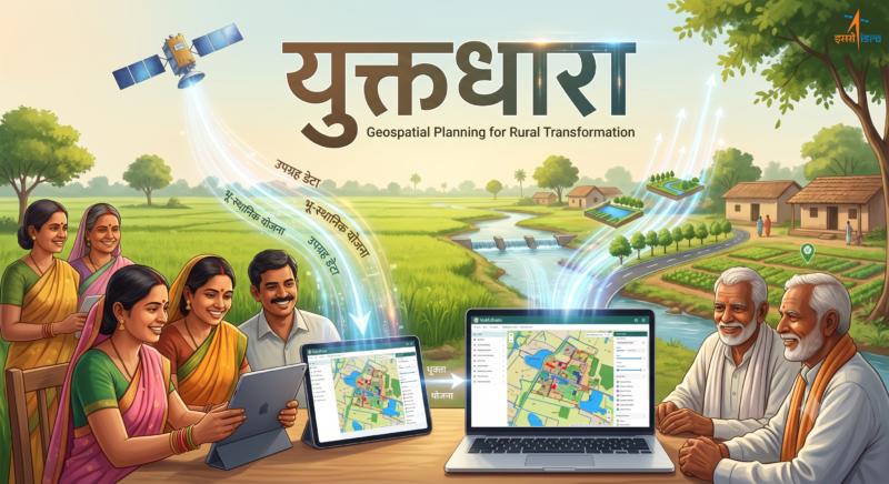
VB-G RAM G VGPP Framework (June 2026) में IndiaWRIS को Yuktdhara Planning Portal के साथ integrate किया गया है।
Gram Panchayat Level पर — IndiaWRIS से मिलता है:
| VGPP Need | IndiaWRIS Layer |
|---|---|
| GW Category (Over-Exploited?) | GW Resources Estimation 2020 |
| River/Drainage mapping | River Layers + Drainage |
| Rainfall data — water budget के लिए | Rainfall Grid |
| Surface water bodies — asset inventory | Water Body Census |
| Flood risk assessment | Flood Lines + Flood Polygon |
| Watershed boundary | Watershed Boundary |
| Aquifer recharge potential | ARS Master Plan |
| Glacier lakes (UK के लिए) | Glacial Lakes |
| Drought severity | Drought District/Block |
VGPP Water Budget में IndiaWRIS का specific role:
- Annual Rainfall → Run-off calculation
- GW Extraction vs Recharge → GW Category determine
- Surface Water Bodies → Existing assets inventory
- Aquifer Recharge Zones → Where to build recharge structures
- Flood Lines → Disaster mitigation works location
India-WRIS कैसे Use करें — Step by Step
Portal पर Data देखें:
Step 1: indiawris.gov.in पर जाएं
Step 2: Dashboard या WebGIS select करें
Step 3: State → District → Block select करें
Step 4: Layer choose करें — Rainfall/GW/River/Reservoir
Step 5: Time period set करें → Data visualize करें
Step 6: Download option → Data export करें
Wiki पर Information:
indiawris.gov.in/wiki → Search → Water body, river, district — जो चाहिए
Atlas Download:
indiawris.gov.in/wris/#/atlas → River Basin Atlas / Watershed Atlas → Download
Uttarakhand और UP में India-WRIS — Relevant Data
Uttarakhand के लिए:
- Ganga, Yamuna, Alaknanda — real-time river gauge
- Himalayan springs — spring source mapping
- Glacial lakes monitoring — GLOF risk
- Mountain watershed boundaries — VGPP planning
- Haridwar, Roorkee — groundwater levels (CGWB data)
Uttar Pradesh के लिए:
- UP — IndiaWRIS को regular data provide करता है।
- Bundelkhand — drought severity mapping
- Western UP — groundwater over-exploitation data
- Eastern UP — flood lines (Ganga, Ghaghra, Rapti)
- Block-wise GW category — VGPP के लिए critical
संबंधित योजनाएं
- VB-G RAM G VGPP Water Budgeting →
- Water Budgeting और Atal Bhujal Yojana →
- जल शक्ति अभियान: Catch the Rain 2026 →
- VB-G RAM G 2026 →
- ई-ग्राम स्वराज Portal →
अक्सर पूछे जाने वाले सवाल
India-WRIS क्या है?
India Water Resources Information System — Ministry of Jal Shakti का NWIC-managed portal — indiawris.gov.in। Comprehensive national GIS framework में water resources data।
India-WRIS कब शुरू हुआ?
CWC और ISRO के MoU से 3 December 2008 को। NWIC को manage करने की ज़िम्मेदारी March 2018 में मिली।
India-WRIS में कितने GIS Layers हैं?
130+ layers — static, dynamic और semi-dynamic।
India-WRIS Free है?
हाँ — public को free access। indiawris.gov.in पर।
Data कौन-कौन से agencies provide करती हैं?
CWC, CGWB, IMD, NRSC और State Governments (UP, AP, Gujarat)।
Real-time data क्या मिलता है?
Rainfall, River water levels और discharge, Groundwater levels, Reservoir storages, Evapotranspiration, Soil moisture।
VGPP में IndiaWRIS कैसे use होता है?
Yuktdhara Planning Portal के through — GW category, rainfall, river, watershed, aquifer data — VGPP Water Budgeting और Gap Assessment में।
Atlas Download कहाँ से होगा?
indiawris.gov.in/wris/#/atlas — River Basin Atlas और Watershed Atlas — free।
Wiki क्या है?
indiawris.gov.in/wiki — collaborative platform — water resources information textual + spatial format में।
Groundwater Block Category कैसे Check करें?
indiawris.gov.in → Groundwater Dashboard → State → District → Block → GW Extraction Category (Over-Exploited/Critical/Semi-Critical/Safe)
आधिकारिक स्रोत
- India-WRIS Portal — indiawris.gov.in
- NWIC — nwic.gov.in
- Wiki — indiawris.gov.in/wiki
- Atlas — indiawris.gov.in/wris/#/atlas
- CWC — cwc.gov.in
- Ministry of Jal Shakti — jalshakti.gov.in

लेखक: सरिता मिश्रा — सरिता “सरकारी योजना” की मुख्य लेखिका हैं। वे केंद्र और राज्य सरकार की योजनाओं पर शोध करके उन्हें आसान हिंदी में समझाती हैं, ताकि हर आम परिवार ज़रूरी जानकारी आसानी से समझ सके। हर लेख आधिकारिक स्रोतों (PIB, मंत्रालय की वेबसाइट और सरकारी पोर्टल) से जाँचने के बाद ही प्रकाशित किया जाता है।