
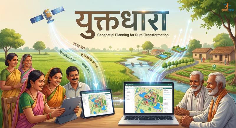
युक्तधारा (Yuktdhara) भारत के ग्रामीण विकास की digital planning का वह invisible engine है जिसके बारे में बहुत कम लोग जानते हैं — लेकिन जिस पर गांव-गांव में होने वाले लाखों रोज़गार कार्यों की planning निर्भर करती है।
युक्तधारा एक geospatial planning portal है जिसे ISRO की Bhuvan platform के तहत ग्रामीण विकास मंत्रालय के साथ मिलकर develop किया गया है। यह multi-temporal IRS satellite imagery और open-source GIS tools को integrate करके ग्राम पंचायत स्तर पर MGNREGA activities की mapping, visualization और geo-tagging की सुविधा देता है।
1 जुलाई 2026 से VB-G RAM G लागू होने के बाद, युक्तधारा की भूमिका और भी महत्वपूर्ण हो जाती है। VB-G RAM G के सभी 318 कार्य VGPP के माध्यम से VB-NRIS और PM Gati Shakti GIS platform पर map होते हैं — और युक्तधारा इस पूरी planning chain का एक महत्वपूर्ण हिस्सा है।
1 अप्रैल 2026 से उत्तर प्रदेश युक्तधारा पोर्टल के साथ integrate हो गया है — ताकि MGNREGA/VB-G RAM G कार्यों की real-time monitoring और planning हो सके।
इस लेख में जानें — युक्तधारा क्या है, कैसे काम करता है, MGNREGA और VB-G RAM G से क्या संबंध है, कौन इसे use करता है, और ग्रामीण भारत के नागरिकों को इससे क्या फायदा होता है।
Table of Contents
📊 युक्तधारा पोर्टल 2026 – एक नज़र में
| विवरण | जानकारी |
|---|---|
| पोर्टल का नाम | युक्तधारा (Yuktdhara) |
| पूरा नाम | युक्तधारा भू-स्थानिक योजना पोर्टल |
| विकसित | ISRO + ग्रामीण विकास मंत्रालय (संयुक्त) |
| Platform | ISRO का Bhuvan |
| Technical Partner | NRSC (National Remote Sensing Centre) |
| लॉन्च | 2021 (Giriraj Singh द्वारा) |
| UP Integration | 1 अप्रैल 2026 से |
| उद्देश्य | GIS-based rural asset planning |
| Satellite Data | IRS (Indian Remote Sensing) — 3m resolution |
| Link | MGNREGA → VB-G RAM G |
| VB-NRIS से संबंध | Integrated |
| Official Portal | bhuvan-app2.nrsc.gov.in |
| Access | Government officials only (MSE + GAS) |
| अंतिम अद्यतन | मई 2026 |
🎯 युक्तधारा क्या है? विस्तृत जानकारी
नाम का अर्थ
युक्तधारा = युक्त (Connected/Integrated) + धारा (Stream/Flow) यानी “एकीकृत प्रवाह” — सभी GIS data और planning एक जगह।
क्यों बनाया गया?
पहले MGNREGA में planning की बड़ी समस्या थी:
- ❌ कागज़ पर planning — बिना actual ground data के
- ❌ Duplication — एक ही जगह दो बार तालाब बन जाता था
- ❌ गलत location — ज़रूरत कहीं और, काम कहीं और
- ❌ पुराने assets की जानकारी नहीं — पहले से बने wells, roads कहाँ हैं?
- ❌ Corruption — फर्जी काम दिखाना आसान था
युक्तधारा ने इस problem का digital solution दिया — satellite data से actual ground truth लाकर planning को evidence-based बनाया।
G2G Service का concept
युक्तधारा ISRO और ग्रामीण विकास मंत्रालय के joint efforts का परिणाम है — यह एक G2G (Government-to-Government) service है जो decentralised decision making को support करती है।
🛰️ युक्तधारा में ISRO की Technology कैसे काम करती है?
यह पोर्टल की सबसे खास बात है — India का space program ग्रामीण रोज़गार की planning में directly काम करता है।
Satellite Data
पोर्टल में multi-temporal IRS satellite data integrate है जो 3 meter से बेहतर resolution में natural color में उपलब्ध है। साथ में digital terrain data और thematic layers भी हैं।
NRSC के Data Layers
NRSC द्वारा wide-ranging national level legacy spatial datasets उपलब्ध कराए जाते हैं:
- Land Use Land Cover (LULC) — 1:10,000 scale
- Roads और Streams — 1:10,000 scale
- Groundwater prospecting
- Geomorphology (भूआकृति विज्ञान)
- Wastelands और Land degradation — 1:50,000 scale
क्या दिखता है Satellite पर?
जब एक ग्राम पंचायत का planner युक्तधारा खोलता है, तो वह देख सकता है:
- गांव की exact boundaries
- पहले से बने तालाब, कुएं, सड़कें
- जलनिकासी pattern (drainage)
- वनस्पति घनत्व (NDVI)
- बंजर और degraded land
- मिट्टी का प्रकार
- पहले किए गए MGNREGA कार्यों की locations
👥 कौन use करता है — MSE और GAS
युक्तधारा portal highly secure है और specifically authorized government functionaries के लिए design किया गया है। Planning activities के लिए दो primary levels of authorization हैं:
MSE — MGNREGA Spatial Enumerator (GP Level)
MSE ग्राम पंचायत स्तर पर operate करता है। वह planning process initiate करता है, satellite data से landscape analyze करता है, specific activities (structural या plantation work) select करता है, और finalized maps approval के लिए submit करता है।
कौन होता है MSE?
- ग्राम रोज़गार सेवक (GRS)
- पंचायत सचिव
- कोई designated village-level official
GAS — GIS Asset Supervisor (Block Level)
GAS ब्लॉक स्तर पर operate करता है। वह MSEs द्वारा upload किए गए plans को view, verify करता है और या तो approve, flag, या revert करता है।
कौन होता है GAS?
- Block Development Officer (BDO)
- या उनके द्वारा designated officer
Login कैसे होता है?
bhuvan-app2.nrsc.gov.in पर जाएं → LOGIN button click करें → GP Planner (MSE) या Block Approver (GAS) select करें → authorized username और password enter करें → CAPTCHA complete करें।
⚠️ आम नागरिकों के लिए: यह portal public registration के लिए नहीं है। केवल pre-authorized government users ही access कर सकते हैं।
📋 9-Stage Digital Workflow — Planning कैसे होती है?
युक्तधारा में नया asset plan बनाना एक strict 9-stage digital workflow follow करता है:
Stage 1: Landscape Familiarization
MSE अपना State, District, Block, और Gram Panchayat select करता है। Satellite imagery और thematic layers (drainage, roads) से local terrain को समझता है।
Stage 2: Existing Assets Review
गांव में पहले से बने तालाब, कुएं, सड़कें, check dams — सब map पर दिखती हैं। यह सुनिश्चित करता है कि duplicate काम न हो।
Stage 3: Need Identification
Satellite data से identify होता है:
- कहाँ पानी की कमी है?
- कहाँ सड़क नहीं है?
- कहाँ soil erosion हो रहा है?
- कहाँ new plantation ज़रूरी है?
Stage 4: Activity Selection
VB-G RAM G के 318 कार्यों में से (या पहले MGNREGA के permitted works में से):
- GAW (Geospatially Analysable Works) — Satellite data automatically suggest करता है
- GNW (Geospatially Non-Analysable Works) — MSE manually add करता है
Stage 5: Geo-Mapping
Selected work की exact GPS coordinates map पर pin होती हैं। हर काम की:
- Location (latitude/longitude — 6 decimal places precision)
- Area/dimensions
- Estimated cost
- Expected beneficiaries
Stage 6: Gram Sabha Resolution Upload
Portal में 3 Gram Sabha Resolutions upload करने की functionality है। ग्राम सभा की मंजूरी बिना काम शुरू नहीं होता — यह digital record हो जाती है।
Stage 7: Block Level Approval
GAS (Block Approver) plan review करता है:
- Satellite data से consistency check
- Duplication check (neighboring GPs के साथ)
- Technical feasibility
- Approve / Revert (पहले Reject था, अब REVERT)
Stage 8: NREGASoft Integration
जब Annual Action Plan पूरी तरह map होकर block authority द्वारा approve होती है, data directly NREGASoft में linked और ingested होता है implementation के लिए।
Live Tracking: अब users Yuktdhara से NREGASoft तक plans के movement को exact timestamps के साथ track कर सकते हैं।
Stage 9: Field Implementation + Monitoring
- काम शुरू होता है
- Geo-tagged photos upload होती हैं
- ISRO satellite से progress monitoring
- Real-time dashboards update होते हैं
🗄️ युक्तधारा किन योजनाओं का Data रखता है?
युक्तधारा पोर्टल विभिन्न राष्ट्रीय ग्रामीण विकास कार्यक्रमों के तहत बनाई गई geo-tagged assets का repository है:
| योजना | क्या track होता है |
|---|---|
| MGNREGA / VB-G RAM G | सभी rural employment works |
| एकीकृत वाटरशेड प्रबंधन | Watershed structures, check dams |
| प्रति बूंद अधिक फसल | Micro-irrigation assets |
| RKVY (राष्ट्रीय कृषि विकास) | Agricultural infrastructure |
| Jal Jeevan Mission | Water supply infrastructure |
यानी एक ग्राम पंचायत में किसी भी योजना के तहत बनी सड़क, तालाब, या कुआँ — सब युक्तधारा के map पर दिखता है।
🔗 युक्तधारा और VB-G RAM G का संबंध
1 जुलाई 2026 से VB-G RAM G लागू होने के बाद युक्तधारा की भूमिका और बड़ी हो जाती है:
VB-G RAM G Planning Chain में युक्तधारा
ग्राम सभा
    ↓
VGPP (विकसित ग्राम पंचायत योजना)
    ↓
युक्तधारा (GIS Mapping + Satellite Analysis)
    ↓
VB-NRIS (Viksit Bharat National Rural Infrastructure Stack)
    ↓
PM Gati Shakti GIS Platform
    ↓
Central Dashboard + ISRO Monitoring
PIB Backgrounder (11 मई 2026) क्या कहता है?
“The planning process has been structured as a bottom-up approach… This system is integrated with PM Gati Shakti, GIS and digital platforms, ensuring scientific and spatial planning.”
यह “GIS and digital platforms” में युक्तधारा directly शामिल है।
VB-G RAM G में क्या बदला?
| MGNREGA में | VB-G RAM G में |
|---|---|
| युक्तधारा: MGNREGA planning | युक्तधारा: VB-G RAM G + VB-NRIS |
| NREGASoft तक integration | PM Gati Shakti GIS तक integration |
| State-level data | National level stack |
| Annual planning | Real-time monitoring |
| Reactive | Predictive (AI analytics) |
🌟 युक्तधारा के 10 बड़े फायदे
1. Duplication खत्म
Satellite पर सब visible — एक गांव में दो बार तालाब नहीं बनेगा।
2. Evidence-based Planning
Guess नहीं, satellite data से decide होगा कि कहाँ क्या ज़रूरी है।
3. भ्रष्टाचार में कमी
Transparency और Accountability — payment processes में anomalies और irregularities minimize होती हैं।
4. Long-term Asset Monitoring
युक्तधारा planning quality सुनिश्चित करेगा, प्रासंगिकता के लिए वर्षों में बनाई गई assets की long-term monitoring को enable करेगा।
5. Natural Resource Management
Watershed, groundwater, soil erosion — सब एक platform पर।
6. Convergence Planning
Line department (convergence) works को planning phase में शामिल करने की provision implement की गई है।
7. Gram Sabha का strengthening
तीन Gram Sabha Resolutions upload करने की facility — digital record।
8. Block-level oversight
GAS की approval से हर काम technically validated होता है।
9. Precision Planning
6 decimal places precision में latitude/longitude — millimeter-level accuracy।
10. Data Export
सभी works को Excel/CSV format में download करने की facility।
📅 UP में युक्तधारा Integration (2026)
1 अप्रैल 2026 से उत्तर प्रदेश युक्तधारा पोर्टल के साथ integrate हो गया है — GIS-powered geospatial planning system से MGNREGA/VB-G RAM G works की real-time monitoring और planning के लिए।
UP Integration के फायदे
- ✅ Comprehensive Records: Action plan, location, cost, और progress — सब record और mapped
- ✅ Transparency और Accountability: Payment anomalies और irregularities कम
- ✅ Direct benefits: Timely employment और development works
- ✅ Open information: Village-level सभी works की accessible जानकारी
- ✅ Corruption minimal: Transparent system में scope नहीं
🆚 युक्तधारा vs पुराना Manual Planning
| पहलू | पुराना तरीका | युक्तधारा |
|---|---|---|
| Data source | कागज़/मौखिक | ISRO Satellite + GIS |
| Planning accuracy | अनुमान | Satellite-verified |
| Duplication check | नहीं/सीमित | Automatic |
| Gram Sabha record | कागज़ | Digital upload |
| Block approval | Office visit | Online dashboard |
| NREGASoft link | Manual entry | Automatic ingestion |
| Monitoring | Field visit | ISRO Satellite real-time |
| Corruption scope | अधिक | बहुत कम |
| Data export | नहीं | Excel/CSV |
| Convergence | नहीं | Line departments included |
📱 युक्तधारा 2026 के नवीनतम Updates
Bhuvan platform ने portal को planning के लिए और बेहतर बनाने के लिए recently कई technical updates किए:
- Live Tracking: Users अब plans के Yuktdhara से NREGASoft तक movement को exact timestamps के साथ track कर सकते हैं
- तीन Gram Sabha Resolutions upload करने की functionality added
- “REJECT” को “REVERT” से replace किया — better workflow
- Latitude/longitude precision 6 digits तक बढ़ाई
- Excel/CSV export — सभी works download कर सकते हैं
- Convergence works — line department works को planning में include करने की provision
- UP Integration (1 अप्रैल 2026) — real-time state-level monitoring
🎓 आम नागरिकों के लिए क्या मायने रखता है?
युक्तधारा एक backend tool है जो आम नागरिक directly use नहीं करता — लेकिन इसके फायदे हर ग्रामीण परिवार को मिलते हैं:
1. बेहतर काम, सही जगह
Satellite data से तय होगा कि आपके गांव में तालाब कहाँ बनना चाहिए — न कि कहाँ सुविधाजनक है।
2. फर्जी काम पकड़ा जाएगा
हर काम geo-tagged है — ISRO satellite देखेगी कि काम actually हुआ या नहीं।
3. मजदूरी सही मिलेगी
NREGASoft integration से payment automatically trigger होगी — कोई manual manipulation नहीं।
4. Public information
Open और accessible information — आप MGNREGA MIS पर अपने गांव के सभी कार्यों की जानकारी देख सकते हैं।
5. Long-term planning
एक बार तालाब बना, satellite उसे track करती रहेगी — 5-10 साल बाद भी।
📞 आधिकारिक स्रोत और सहायता
- युक्तधारा Portal: bhuvan-app2.nrsc.gov.in
- ISRO Bhuvan: bhuvan.nrsc.gov.in
- NRSC: nrsc.gov.in
- ग्रामीण विकास मंत्रालय: rural.gov.in
- NREGASoft: nregasoft.mrd.nic.in
- VB-G RAM G Helpline: 1800-180-1551
🔗 संबंधित लेख
- VB-G RAM G अधिनियम 1 जुलाई 2026
- VB-G RAM G और PM Gati Shakti एकीकरण
- VB-G RAM G 318 कार्य Schedule I
- VB-G RAM G vs MGNREGA
- प्रधानमंत्री गति शक्ति योजना
अक्सर पूछे जाने वाले प्रश्न (FAQ)
युक्तधारा पोर्टल क्या है?
युक्तधारा एक geospatial planning portal है जिसे ISRO की Bhuvan platform के तहत ग्रामीण विकास मंत्रालय के साथ मिलकर develop किया गया है। यह multi-temporal IRS satellite imagery और GIS tools का उपयोग करके ग्राम पंचायत स्तर पर MGNREGA और VB-G RAM G activities की mapping, visualization और geo-tagging करता है। सरल शब्दों में: ISRO की satellite technology ग्रामीण रोज़गार कार्यों की planning में directly काम करती है।
युक्तधारा किसने बनाया और कब लॉन्च हुआ?
युक्तधारा ISRO और ग्रामीण विकास मंत्रालय के joint efforts का result है। इसे ग्रामीण विकास एवं पंचायती राज मंत्री गिरिराज सिंह ने launch किया था। यह 2021 में launch हुआ था और तब से continuously upgrade हो रहा है। 2026 में UP integration और कई नए technical features add किए गए हैं।
युक्तधारा और VB-G RAM G में क्या संबंध है?
VB-G RAM G Act 2025 (1 जुलाई 2026 से लागू) में VGPP (विकसित ग्राम पंचायत योजना) के सभी कार्य VB-NRIS और PM Gati Shakti GIS Platform पर map होते हैं। युक्तधारा इस planning chain का महत्वपूर्ण GIS tool है। यह ग्राम पंचायत level पर satellite-based analysis करता है, जो VGPP की quality और accuracy सुनिश्चित करता है। पूरी chain है: ग्राम सभा → VGPP → युक्तधारा GIS → VB-NRIS → PM Gati Shakti → ISRO Monitoring।
क्या आम नागरिक युक्तधारा portal access कर सकते हैं?
नहीं। युक्तधारा highly secure है और specifically authorized government functionaries के लिए design किया गया है। कोई public registration नहीं है। Only pre-authorized users assigned credentials के साथ dashboard access कर सकते हैं। हालांकि इसके benefits — better planning, less corruption, accurate works — हर ग्रामीण नागरिक को मिलते हैं।
युक्तधारा में MSE और GAS कौन होते हैं?
MSE (MGNREGA Spatial Enumerator) ग्राम पंचायत स्तर पर operate करता है — वह planning initiate करता है, satellite data analyze करता है, activities select करता है। GAS (GIS Asset Supervisor) ब्लॉक स्तर पर operate करता है — वह MSE द्वारा submit किए plans को verify और approve/revert करता है।
युक्तधारा ISRO की satellite से कैसे जुड़ा है?
युक्तधारा में IRS (Indian Remote Sensing) satellite का multi-temporal data integrate है जो 3 meter से बेहतर resolution में natural color में उपलब्ध है। NRSC (National Remote Sensing Centre) Land Use Land Cover, roads, drainage, groundwater prospecting, geomorphology जैसे layers provide करता है। यह data planning को purely evidence-based बनाता है।
युक्तधारा और NREGASoft में क्या अंतर है?
युक्तधारा geographical planning का tool है — यह तय करता है कि काम कहाँ होगा और क्यों। NREGASoft सभी subsequent reporting, worker tracking और administrative data manage करता है। दोनों linked हैं: जब Annual Action Plan Yuktdhara में fully mapped और approved होती है, data directly NREGASoft में ingest होता है।
UP में युक्तधारा integration 2026 में क्यों महत्वपूर्ण है?
1 अप्रैल 2026 से उत्तर प्रदेश युक्तधारा के साथ integrate हुआ ताकि MGNREGA/VB-G RAM G works की real-time monitoring और planning हो सके। UP में MGNREGA के अंतर्गत सबसे ज़्यादा beneficiaries हैं। यह integration transparency बढ़ाएगी, payment anomalies कम होंगी और VB-G RAM G transition smoother होगा। इससे timely employment, development works और accessible village-level information मिलेगी।
युक्तधारा के 2026 में क्या नए updates आए?
2026 में युक्तधारा के प्रमुख updates: (1) Live Tracking — Yuktdhara से NREGASoft तक exact timestamps (2) 3 Gram Sabha Resolutions upload करने की facility (3) “REJECT” → “REVERT” (4) Latitude/longitude 6 decimal precision (5) Excel/CSV export (6) Convergence works — line departments inclusion। UP integration भी 2026 का बड़ा milestone है।
युक्तधारा UPSC के लिए क्यों महत्वपूर्ण है?
युक्तधारा UPSC Prelims और Mains दोनों के लिए relevant है: Prelims — Science & Technology + Rural Development current affairs। Mains GS-3 — Technology for rural development, MGNREGA, GIS applications। Key points: ISRO + MRD joint initiative, Bhuvan platform, MSE/GAS roles, 9-stage workflow, NREGASoft integration, VB-G RAM G में relevance, UP integration (April 2026)। यह “Space technology for rural governance” का best example है।
डिसक्लेमर
यह लेख ISRO, NRSC और ग्रामीण विकास मंत्रालय की आधिकारिक जानकारी के आधार पर तैयार है। नवीनतम जानकारी के लिए bhuvan-app2.nrsc.gov.in और rural.gov.in देखें।
स्रोत: ISRO Bhuvan | NRSC | ग्रामीण विकास मंत्रालय | PIB India
लेखक: सरिता मिश्रा — सरिता “सरकारी योजना” की मुख्य लेखिका हैं। वे केंद्र और राज्य सरकार की योजनाओं पर शोध करके उन्हें आसान हिंदी में समझाती हैं, ताकि हर आम परिवार ज़रूरी जानकारी आसानी से समझ सके। हर लेख आधिकारिक स्रोतों (PIB, मंत्रालय की वेबसाइट और सरकारी पोर्टल) से जाँचने के बाद ही प्रकाशित किया जाता है।
3 thoughts on “युक्तधारा पोर्टल 2026: ISRO का GIS-आधारित ग्रामीण योजना पोर्टल – MGNREGA से VB-G RAM G तक पूरी जानकारी”